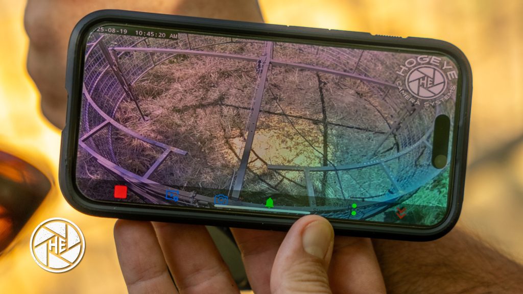
Feral hog management is experiencing a digital revolution. With new apps, mapping platforms, and connected camera systems, landowners and ranchers now have powerful tools to track hog activity, map damage, and organize community-level responses. This comprehensive guide breaks down the leading apps and data solutions, shows real screenshots, and walks you through how technology can dramatically reduce feral hog losses.
1. Why Use Apps and Data Tools for Hog Monitoring?
- Record and visualize hog sightings, rooting, and crop damage using your smartphone.
- Track movement patterns over time and spot invasion trends on interactive maps.
- Receive live camera alerts and analyze event histories for smarter, faster response.
- Share findings instantly with neighbors or wildlife agencies for coordinated action.
2. Top App & Tool Recommendations
HogEye Camera App
- Integrates real-time video monitoring and motion alerts with app-based camera control.
- Stream remotely, share camera access, store cloud footage, and trigger custom notifications.
- Best for: On-site and remote management, integrating with other trap/camera systems.
HuntStand & HuntWise
- Industry leaders for mapping property boundaries, marking hog trails, and sharing pin locations.
- Features weather and moon phase overlays plus in-field photo logging for damage or animal sign.
- Best for: Landowners with multiple parcels or community surveillance teams.
FeralPigScan (Australia) and Feral Hog Damage Apps (US/MSU)
- Mapping and survey tools designed to record hog sightings, rooting sites, wallows, and fence breaks.
- Collects spatial data, cost estimates, and damage photos, feeding into community wildlife databases.
- Best for: Reporting to local authorities, large-scale or public land management, grant-funded monitoring.
Hog Havoc (Tall Timbers Research)
- Free smartphone app lets the public quickly report hog activity, add GPS locations, and send photos.
- Used by biologists for targeted trapping and resource allocation.
- Best for: Community science, group management, and regional research projects.
iTrack Wildlife
- Digital animal tracks field guide: ID prints and sign directly from your phone.
- Best for: Verifying unknown damage, distinguishing hogs from deer, cattle, or wildlife.
3. Guide to Using Apps & Data for Smarter Hog Management
- Setup: Download the app, create an account, and set up property boundaries or zones.
- Documentation: Record every instance of rooting, damage, or hog sightings with pins, GPS notes, and photos.
- Live Monitoring: Enable real-time alerts from monitoring cameras, and receive push notifications for movements or breaches.
- Mapping Trends: Compare locations of repeated hog activity to predict their travel routes and seasonal changes.
- Sharing & Collaboration: With most apps, you can invite neighbors, ranch partners, or local agencies—building a coordinated, fast response network.
- Cost Assessment: Use field entry forms to quickly estimate economic losses, generate reports, and support insurance or grant applications.
4. Visual How-To and Screenshots
- Show sample app dashboard: marking damage, adding photos, property layout
- Example alert from HogEye: “Motion detected, South Pasture, 2:13 am”
- Mapping feature: before/after map of hog incursions
5. Pitfalls & Pro Tips
- Always back up app data to the cloud or export for long-term tracking.
- Combine camera apps and mapping apps for full-picture situational awareness.
- For rural or no-signal areas, log data offline and upload when back in range.
6. Future: AI, Drone, and Data Integration
- Look for future AI enhancements in detection and alert accuracy (already in latest HogEye releases).
- Drones will expand automated damage mapping and herd counting over large acreage.
- Expect statewide management databases to become the backbone of regional policy and funding for hog abatement.
Internal Links
- Blog 5: Top 5 Hog Monitoring Mistakes (And How to Avoid Them)
- Feral Hog Monitoring Category Page
Call to Action
Don’t monitor alone—let app-based tools and live data show you where, when, and how to act. Download a trusted hog monitoring app, integrate with your HogEye system, and join the new era of land protection.

